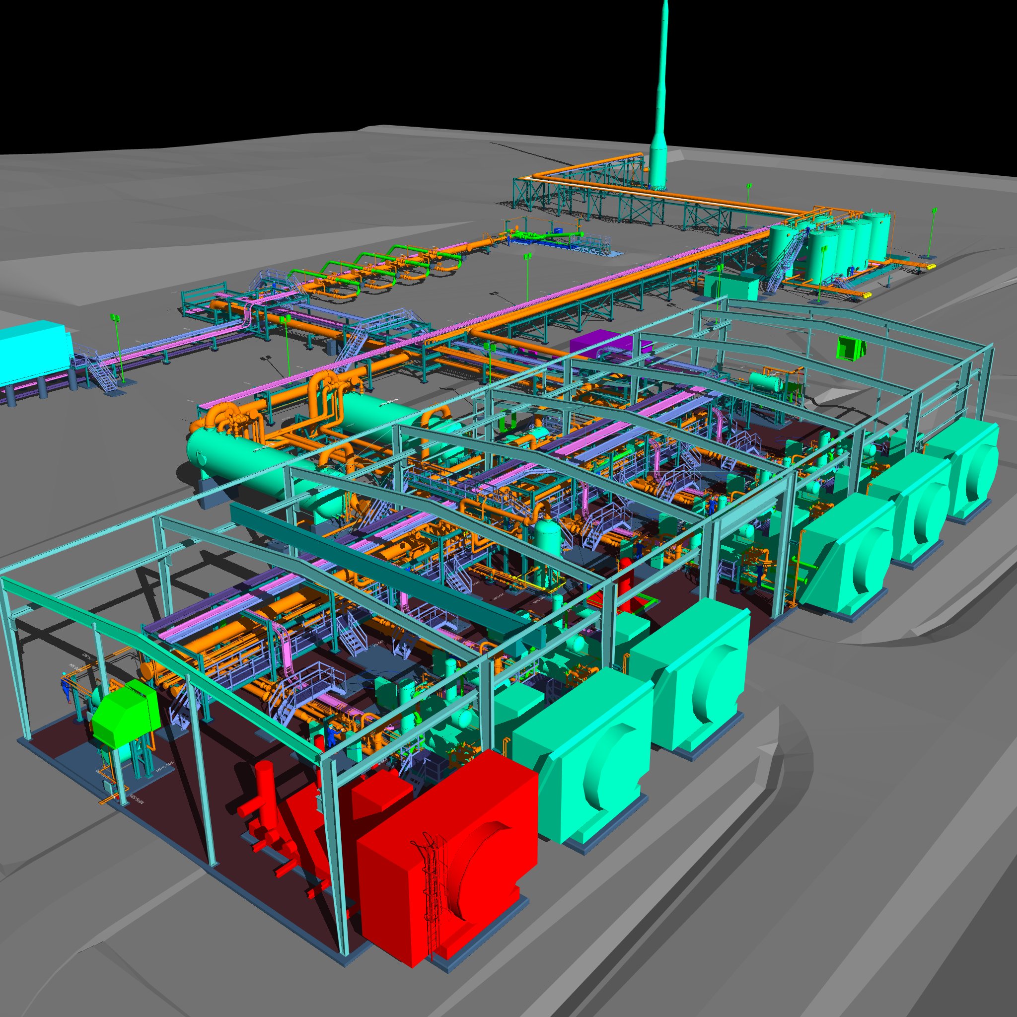
Industrial facilities operators and owners rely on standard engineering design tools, like laser scanners and 3D modeling, to provide multi-dimensional, matrixed models of facilities to foresee design conflicts and optimize layouts, substantially reducing project risk.
The virtual models, rendered from laser scans using millions of intersecting points gathered per second, provide owners with project progression, cost oversight, and critical facility layout information to enhance decision-making.
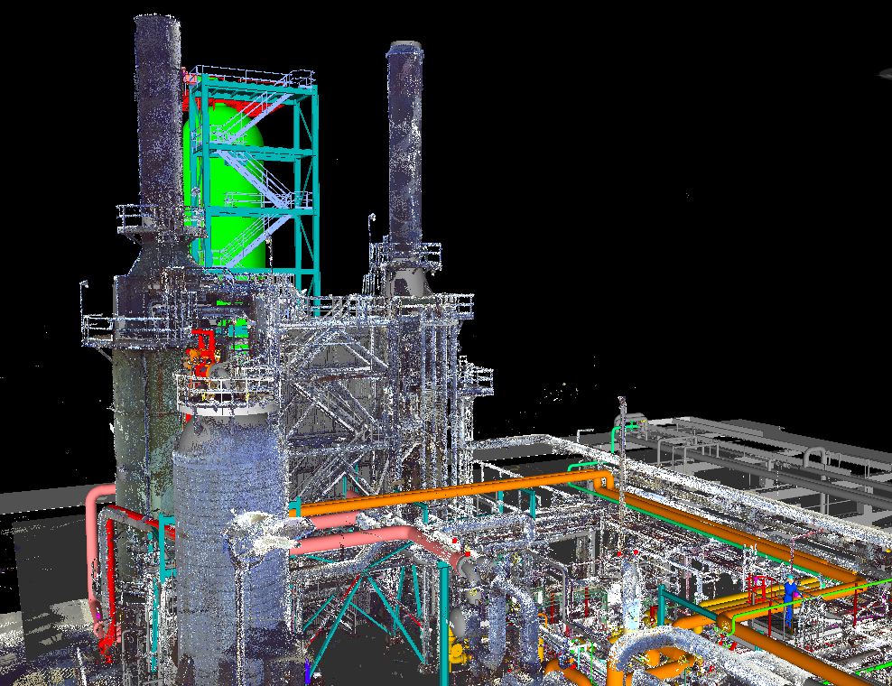
Multi-disciplined engineering teams are able to laser scan as-built facilities, assets, and other details that may impact project scope using precise point-to-point measurements at 976,000 points per second for 1/16th of an inch field measurement accuracy.
These precise measurements are then used to produce 360° full‑color photographic images from each scan location so that engineers and designers can build 3D “as-built” point cloud design models.
“Our technicians perform thousands of lasers scans a year across hundreds of complex engineering projects in the energy, sustainability, and advanced manufacturing sectors,” said Rod VanderWerff, Resource Manager, Piping Design at Anvil Corporation, “Laser scans give us the ability to safely capture high resolution images even in hard to access, confined spaces like storage tanks, pipe ways, and other process equipment.”
Scanning constricted, underground areas, (i.e., electrical vaults) has traditionally been a difficult and unsafe procedure. With laser scanning, technicians can now lower the scanner in an inverted position to capture the images, maximizing both productivity and safety.
Conducting virtual, 3D model “walk throughs,” in real-time from anywhere around the world, engineers, designers, owners, and constructors can collaborate to:
- Identify line and equipment tie-ins for highly accurate P&IDs and to greatly reduce field welding during installations.
- View in real-time, the changing conditions in an industrial facility or refinery before, during, or after revamps and extensive mechanical work.
- Plan for constructability and operability to minimize field work.
- Document what has not been documented when facility drawings are inaccurate, not available, need to be updated, or when new designs need to align with old designs.
Using programs like 3D Studio Max or AutoCAD Simulate’s video tools, engineers and designers are then able to animate 3D models to produce overlays such as 4D schedule models depicting work packaging and sequence of construction activities on moving timelines highlighting schedule milestones further overlaid with 5D cost models and 6D lifecycle models depicting the project’s lifecycle after construction.
However, there are a number of factors that can impact the accuracy of the laser scans in the field, such as technician training, adverse weather conditions, and motion.
Continue Reading on Plant Engineering →